
Gambar:Lori.svg

Ukuran ieu pramidang PNG ti ieu berkas SVG: 587 × 599 pixel Resolusi lianna: 235 × 240 pixel | 470 × 480 pixel | 752 × 768 pixel | 1.003 × 1.024 pixel | 2.006 × 2.048 pixel | 725 × 740 pixel.
Berkas asli (Koropak SVG, nominalna 725 × 740 piksel, ukuranana 72 KB)
| Berkas ieu asalna ti Wikimedia Commons. Kaca ngeunaan katerangan berkas ieu di Commons aya disalin di handap. Commons téh hiji gudang berkas bébas nu eusina disumbang ku balaréa. |
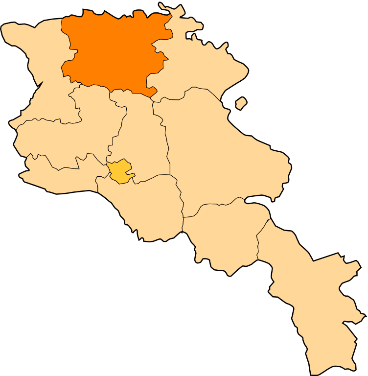
| Pedaran | Image shows the eleven administrative subdivisions of Armenia: # Aragatsotn (Արագածոտնի) # Ararat (Արարատի) # Armavir (Արմավիրի) # Gegharkunik (Գեղարքունիքի) # Kotayk (Կոտայքի) # Lori (Լոռու) # Shirak (Շիրակի) # Syunik (Սյունիքի) # Tavush (Տավուշի) # Vayots Dzor (Վայոց Ձորի) # Yerevan (Երևան) - special administrative status Derived from a multiple of public sources and created using Inkscape. == |
| Titimangsa | (UTC) |
| Sumber | |
| Pangarang |
|
| Ini merupakan gambar hasil penyuntingan yang berarti bahwa gambar tersebut telah diubah secara digital dari versi asli. Perubahan: Creation d'une autre map. Versi asli dapat dilihat di sini: Armenia map numbered.svg:
|
Ieu berkas dilisénsikeun maké lisénsi Creative Commons Attribution-Share Alike 3.0 Unported.
- Anjeun bébas:
- pikeun babagi – pikeun nyalin, nyebarkeun, sarta nyalabarkeun karyana
- pikeun nyampurkeun – pikeun ngarobah karyana
- Dumasar kana kaayaan di handap:
- atribusi – Anjeun kudu ngatribusi karya ku cara nu geus ditangtukeun ku nu nyieun atawa nu méré lisénsi (tapi lain ku jalan nu sigana téh maksa pikeun Anjeun maké éta karya).
- BabagiSarupa – Lamun anjeun ngadumaniskeun, ngarobah, atawa nyieun turunan tina éta bahan, anjeun kudu nyebarkeun kontribusi anjeun maké lisénsi anu sarua jeung nu aslina.
Log pengunggahan asli
This image is a derivative work of the following images:
- File:Armenia_map_numbered.svg licensed with Cc-by-sa-3.0-migrated, GFDL
- 2010-09-26T17:27:10Z 6AND5 725x740 (82221 Bytes) Reverted to version as of 17:31, 25 November 2006 (((Exclaves deleted according to official map at http://www.gov.am/en/regions/)))
- 2006-11-25T19:37:43Z Bastique 725x740 (87638 Bytes) Cleanup
- 2006-11-25T19:26:57Z Bastique 725x740 (86083 Bytes) Enclaves
- 2006-11-25T17:31:38Z Bastique 725x740 (82221 Bytes) Fixed canvas size
- 2006-11-25T17:27:59Z Bastique 744x1052 (79767 Bytes) Image shows the subdivisions of Armenia. Derived from a multiple of public sources and created using Inkscape. == Licensing == {{GFDL}} Image shows the eleven administrative subdivisions of Armenia: #[[Aragatsotn]] (Ար�
Uploaded with derivativeFX
Jujutan berkas
Klik dina titimangsa pikeun nempo koropak nu aya dina mangsa éta.
| Titimangsa | Miniatur | Ukuran | Pamaké | Kamandang | |
|---|---|---|---|---|---|
| kiwari | 30 Désémber 2010 11.28 | | 725 × 740 (72 KB) | Varmin | {{Information |Description=Image shows the eleven administrative subdivisions of Armenia: # Aragatsotn (Արագածոտնի) # Ararat (Արարատի) # Armavir (Արմավիրի) # Gegharkunik (Գեղ |
Pamakéan berkas
Ieu berkas dipaké ku kaca di handap:
Pamakéan berkas sajagat
Wiki lianna anu maké ieu berkas:
- Pamakéan di ar.wikipedia.org
- Pamakéan di be.wikipedia.org
- Pamakéan di bg.wikipedia.org
- Pamakéan di ceb.wikipedia.org
- Pamakéan di ce.wikipedia.org
- Акнер
- Бендик
- Арманис
- Агарак (Лорин провинци)
- Азнвадзор
- Атан
- Ахнидзор
- Амракиц
- Айгеат
- Антарамут
- Апавен
- Ардви
- Арцни
- Ахтала (Лорин провинци)
- Арчут
- Арчут (станци)
- Аревацаг
- Аревашох
- Акори
- Базум
- Благодарни (Эрмалойчоь)
- Бовадзор
- Гаргар
- Гегасар
- Гюлагарак
- Гогаран
- Гугарк
- Дарпас
- Дебет
- Дсех
- Ехегнут
- Техут (Лорин провинци)
- Леджан
- Лернаовит
- Лернанцк
- Лернапат
- Лернаван
- Лермонтов (Лорин провинци)
Témbongkeun pamakéan global leuwih loba pikeun ieu berkas.