
Gambar:Administrative divisions of Germany, February 1944.png
Ukuran ieu pramidang: 773 × 600 pixel. Resolusi lianna: 310 × 240 pixel | 619 × 480 pixel | 990 × 768 pixel | 1.280 × 993 pixel | 2.607 × 2.022 pixel.
Berkas asli (2.607 × 2.022 piksel, ukuran koropak: 577 KB, tipeu MIME: image/png)
| Berkas ieu asalna ti Wikimedia Commons. Kaca ngeunaan katerangan berkas ieu di Commons aya disalin di handap. Commons téh hiji gudang berkas bébas nu eusina disumbang ku balaréa. |
Ringkesna
| Pedaran |
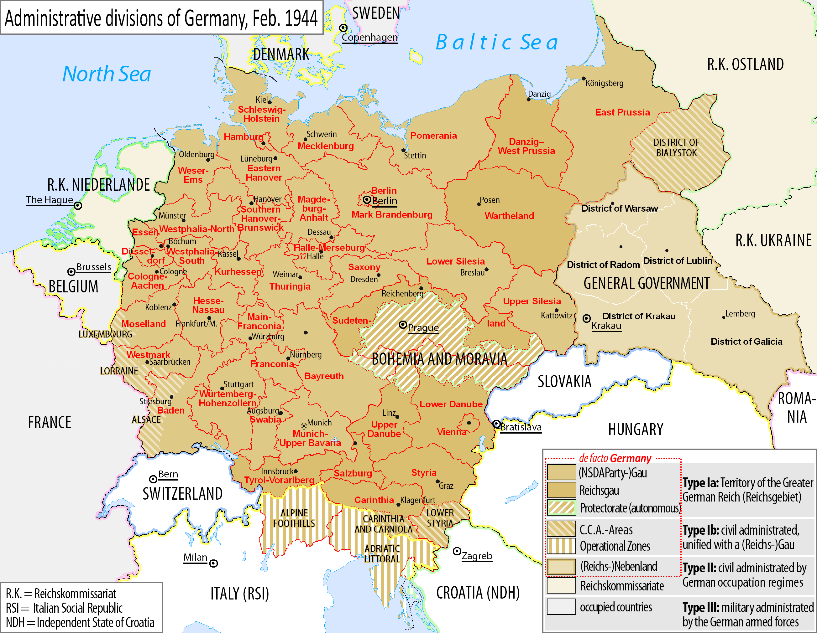
English: Map of the NSDAP administrative divisions of Germany, February 1944.
Deutsch: Englischsprachige Karte der administrative Gliederung des Großdeutschen Reiches durch die NSDAP 1944.
Polski: Mapa Wielkiej Rzeszy Niemieckiej (1944) |
||||
| Titimangsa | |||||
| Sumber | File:Grossdeutsches_Reich_NS_Administration_1944.png | ||||
| Pangarang | DIREKTOR (derived from Exec's file) | ||||
| Widi (Migunakeun deui ieu berkas) |
Berkas ini dilisensikan di bawah lisensi Creative Commons Atribusi-Berbagi Serupa 4.0 Internasional.
|
||||
| Versi lainnya |
|


Jujutan berkas
Klik dina titimangsa pikeun nempo koropak nu aya dina mangsa éta.
| Titimangsa | Miniatur | Ukuran | Pamaké | Kamandang | |
|---|---|---|---|---|---|
| kiwari | 8 Oktober 2021 12.25 | | 2.607 × 2.022 (577 KB) | Kamilhrub | Corrected border of Lublin and Galicia districts, which didn't change after 1941 (source: Amtliches Gemeinde- und Dorfverzeichnis für das Generalgouvernement auf Grund der Summarischen Bevölkerungsbestandsaufnahme am 1. März 1943) |
| 5 Pébruari 2017 05.36 |  | 2.607 × 2.022 (563 KB) | DIREKTOR | Legend frames. | |
| 4 Pébruari 2017 13.23 |  | 2.607 × 2.022 (563 KB) | DIREKTOR | Further error corrections ("Francfort", "Berne", etc.) | |
| 4 Pébruari 2017 11.08 |  | 2.607 × 2.022 (594 KB) | DIREKTOR | Error corrections. | |
| 3 Pébruari 2017 12.49 |  | 2.607 × 2.022 (614 KB) | DIREKTOR | User created page with UploadWizard |
Pamakéan berkas
Euweuh kaca anu maké ieu berkas.