
Gambar:Macau locator map.svg

Ukuran ieu pramidang PNG ti ieu berkas SVG: 705 × 599 pixel Resolusi lianna: 282 × 240 pixel | 565 × 480 pixel | 904 × 768 pixel | 1.205 × 1.024 pixel | 2.409 × 2.048 pixel | 1.067 × 907 pixel.
Berkas asli (Koropak SVG, nominalna 1.067 × 907 piksel, ukuranana 313 KB)
| Berkas ieu asalna ti Wikimedia Commons. Kaca ngeunaan katerangan berkas ieu di Commons aya disalin di handap. Commons téh hiji gudang berkas bébas nu eusina disumbang ku balaréa. |
Ringkesna
| Pedaran |
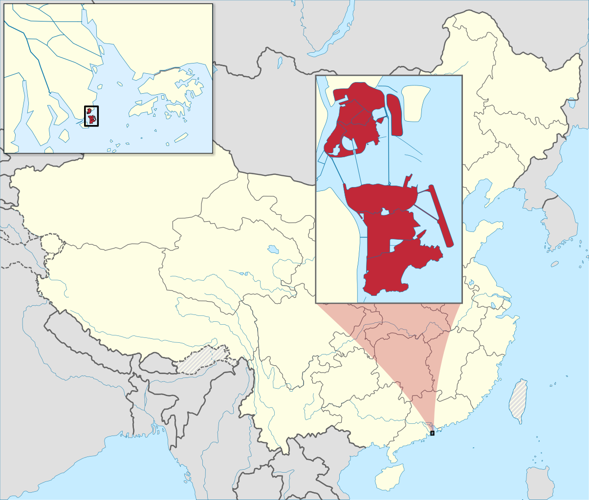
English: Locator map of Macau, China.
Français : Carte de localisation de Macao, Chine. |
| Titimangsa | (UTC) |
| Sumber | |
| Pangarang | |
| Versi lainnya | |
| Atribusi (required by the license) | © Sémhur / Wikimedia Commons / |
| SVG | W3C-validity not checked. W3C-unspecified Gambar vektor ini dibuat menggunakan Inkscape . |
| Graphic Lab |
.svg)
| Lokasi kamera | | Lihat gambar ini dan gambar di sekitarnya di: OpenStreetMap |
|---|
Lisénsi
Saya, pemilik hak cipta dari karya ini, dengan ini menerbitkan berkas ini di bawah ketentuan berikut:
| Non hak cipta: Karya seni ini bebas; Anda dapat mendistribusikan dan/atau memodifikasi dokumen ini di bawah syarat-syarat Lisensi Seni Bebas. Anda akan menemukan salinan lisensi ini di situs Persyaratan Non Hak Cipta sebagaimana pada situs-situs lain. |
This file is licensed under the Creative Commons Attribution-Share Alike 4.0 International, 3.0 Unported, 2.5 Generic, 2.0 Generic and 1.0 Generic license.
- Anjeun bébas:
- pikeun babagi – pikeun nyalin, nyebarkeun, sarta nyalabarkeun karyana
- pikeun nyampurkeun – pikeun ngarobah karyana
- Dumasar kana kaayaan di handap:
- atribusi – Anjeun kudu ngatribusi karya ku cara nu geus ditangtukeun ku nu nyieun atawa nu méré lisénsi (tapi lain ku jalan nu sigana téh maksa pikeun Anjeun maké éta karya).
- BabagiSarupa – Lamun anjeun ngadumaniskeun, ngarobah, atawa nyieun turunan tina éta bahan, anjeun kudu nyebarkeun kontribusi anjeun maké lisénsi anu sarua jeung nu aslina.
Anjeun bisa milih lisénsi nu cocog.
Log pengunggahan asli
This image is a derivative work of the following images:
- File:China_Macau.svg licensed with PD-self
- 2008-08-13T16:28:07Z Joowwww 1000x850 (212000 Bytes) added missing laos/vietnam border
- 2008-05-14T11:19:01Z Joowwww 1000x850 (210391 Bytes) {{Information |Description=An SVG map of China with the Macau special administrative region highlighted and circled Legend:[[Image:China map legend.png]] |Source=self-made; based on CIA public domain maps: *http://www.lib.ut
- File:Macau_Location.svg licensed with PD-self
- 2009-05-06T03:17:53Z ASDFGHJ 1270x640 (235764 Bytes) .
- 2009-05-06T03:16:44Z ASDFGHJ 1270x640 (235753 Bytes) still looks small in size
- 2009-05-06T03:10:04Z ASDFGHJ 1270x640 (235799 Bytes) add airport
- 2009-05-06T02:19:30Z ASDFGHJ 1270x640 (235052 Bytes) More closer zoom
- 2009-05-06T02:15:43Z ASDFGHJ 1270x640 (235024 Bytes) Zoom in the map more
- 2009-05-06T01:56:08Z ASDFGHJ 1270x640 (234931 Bytes) {{Information |Description=A map showing Macau's location in Asia, in China and on China's south coast. |Source=[[:file:Hong Kong Location.svg]] by [[User:Joowwww|Joowwww]] |Date=2008-04-09 |Author= [[:en:User:ASDFGH|ASDFGHJ]
- File:People's_Republic_of_China_(orthographic_projection).svg licensed with Cc-by-sa-3.0,2.5,2.0,1.0, GFDL, GFDL-GMT
- 2009-05-13T23:18:42Z Shibo77 541x541 (492315 Bytes) Reverted to version as of 20:43, 16 February 2009
- 2009-05-11T07:14:38Z Jjhcap99 541x541 (510234 Bytes) Reverted to version as of 16:53, 16 February 2009
- 2009-02-16T20:43:19Z Shibo77 541x541 (492315 Bytes) Reverted to version as of 01:23, 14 February 2009
- 2009-02-16T16:53:16Z Uirauna 541x541 (510234 Bytes) Reverted to version as of 17:30, 9 February 2009 to reflect the NPOV rules, claimed territories should not be marked light green in the map
- 2009-02-14T01:23:58Z Shibo77 541x541 (492315 Bytes) ..
- 2009-02-14T01:09:04Z Shibo77 541x541 (488887 Bytes) Reverted to version as of 01:10, 27 October 2008
- 2009-02-09T17:34:05Z Uirauna 541x541 (510234 Bytes) Sorry, I uploaded the wrong file, this is the correct one.
- 2009-02-09T17:30:31Z Uirauna 541x541 (510234 Bytes) According to the [[Wikipedia:Neutral point of view]] rules, I have removed the light green marks over the regions claimed by PRC but controlled by other nationas, such as Taiwan and Arunachal Pradesh. Other country maps ( suc
- 2008-10-27T01:10:00Z Ssolbergj 541x541 (488887 Bytes) {{Information |Description={{en|1=The People's Republic of China (green) and its claimed territory (lighter green).}} |Source=as |Author=~~~ |Date=27 October 2008 |Permission= |other_versions= }} [[Category:Maps of China]]
- File:MapOfMacauMunicipalities.svg licensed with PD-self
- 2009-06-22T22:39:10Z Cdip150 420x640 (38446 Bytes) {{Information |Description={{en|A map showing the municipalities of Macau SAR {{zh-hant|[[:zh:澳門行政區劃|]]地圖}}}} {{Inkscape}} |Source=self |Date=2009-6-23 |Author=[[User:Cdip150]] |Permission= |other_versions= }
Uploaded with derivativeFX
Jujutan berkas
Klik dina titimangsa pikeun nempo koropak nu aya dina mangsa éta.
| Titimangsa | Miniatur | Ukuran | Pamaké | Kamandang | |
|---|---|---|---|---|---|
| kiwari | 21 Méi 2022 13.40 | | 1.067 × 907 (313 KB) | Crab2814 | Recoloured the mini-map. |
| 20 Méi 2022 15.50 |  | 1.067 × 907 (314 KB) | Crab2814 | Updated the map so it looks more the Hong Kong locator map. | |
| 18 Méi 2022 10.32 |  | 1.067 × 907 (327 KB) | Crab2814 | Updated the colour scheme. | |
| 14 Januari 2010 18.26 |  | 1.000 × 850 (326 KB) | Sémhur | == {{int:filedesc}} == {{Information |Description={{en|1=Locator map of Macau, China.}} {{fr|1=Carte de localisation de Macao, Chine.}} |Source=*File:China_Macau.svg *File:Macau_Location.svg *[[:File:People's_Republ |
Pamakéan berkas
Ieu berkas dipaké ku kaca di handap:
Pamakéan berkas sajagat
Wiki lianna anu maké ieu berkas:
- Pamakéan di alt.wikipedia.org
- Pamakéan di ami.wikipedia.org
- Pamakéan di am.wikipedia.org
- Pamakéan di an.wikipedia.org
- Pamakéan di ar.wikipedia.org
- Pamakéan di arz.wikipedia.org
- Pamakéan di ast.wikipedia.org
- Pamakéan di as.wikipedia.org
- Pamakéan di av.wikipedia.org
- Pamakéan di azb.wikipedia.org
- Pamakéan di az.wikipedia.org
- Pamakéan di ba.wikipedia.org
- Pamakéan di be-tarask.wikipedia.org
- Pamakéan di be.wikipedia.org
- Pamakéan di bn.wikipedia.org
- Pamakéan di bxr.wikipedia.org
- Pamakéan di ca.wikipedia.org
- Pamakéan di ceb.wikipedia.org
- Pamakéan di ce.wikipedia.org
- Pamakéan di chr.wikipedia.org
- Pamakéan di ckb.wikipedia.org
- Pamakéan di crh.wikipedia.org
- Pamakéan di cs.wikipedia.org
- Pamakéan di da.wikipedia.org
- Pamakéan di diq.wikipedia.org
- Pamakéan di dty.wikipedia.org
- Pamakéan di dz.wikipedia.org
- Pamakéan di en.wikipedia.org
- Pamakéan di en.wikinews.org
- Pamakéan di eo.wikipedia.org
- Pamakéan di es.wikipedia.org
- Pamakéan di es.wikivoyage.org
- Pamakéan di es.wiktionary.org
- Pamakéan di fa.wikipedia.org
- Pamakéan di fi.wikipedia.org
- Pamakéan di fi.wiktionary.org
- Pamakéan di fr.wikipedia.org
Témbongkeun pamakéan global leuwih loba pikeun ieu berkas.