
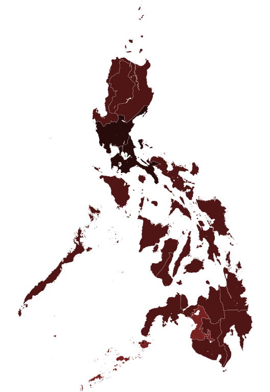
Gambar:COVID-19 pandemic cases in the Philippines by region.svg

Ukuran ieu pramidang PNG ti ieu berkas SVG: 412 × 599 pixel Resolusi lianna: 165 × 240 pixel | 330 × 480 pixel | 528 × 768 pixel | 704 × 1.024 pixel | 1.409 × 2.048 pixel | 4.200 × 6.105 pixel.
Berkas asli (Koropak SVG, nominalna 4.200 × 6.105 piksel, ukuranana 2,02 MB)
| Berkas ieu asalna ti Wikimedia Commons. Kaca ngeunaan katerangan berkas ieu di Commons aya disalin di handap. Commons téh hiji gudang berkas bébas nu eusina disumbang ku balaréa. |
Ringkesna
| Pedaran |
|
||
| Titimangsa | (UTC) | ||
| Sumber |
This file was derived from: Philippines, administrative divisions - de - colored.svg:  |
||
| Pangarang |
|
||
| Versi lainnya |
|
||
| SVG genesis |

Lisénsi
Saya, pemilik hak cipta dari karya ini, dengan ini menerbitkan berkas ini di bawah ketentuan berikut:
Ieu berkas dilisénsikeun maké lisénsi Creative Commons Attribution-Share Alike 3.0 Unported.
- Anjeun bébas:
- pikeun babagi – pikeun nyalin, nyebarkeun, sarta nyalabarkeun karyana
- pikeun nyampurkeun – pikeun ngarobah karyana
- Dumasar kana kaayaan di handap:
- atribusi – Anjeun kudu ngatribusi karya ku cara nu geus ditangtukeun ku nu nyieun atawa nu méré lisénsi (tapi lain ku jalan nu sigana téh maksa pikeun Anjeun maké éta karya).
- BabagiSarupa – Lamun anjeun ngadumaniskeun, ngarobah, atawa nyieun turunan tina éta bahan, anjeun kudu nyebarkeun kontribusi anjeun maké lisénsi anu sarua jeung nu aslina.

|
Widi dipaparinkeun pikeun nyalin, nyebarkeun jeung/atawa ngarobah ieu dokumén dina payung GNU Free Documentation License, Vérsi 1.2 atawa saluhureunana anu medal ti Free Software Foundation; tanpa Invariant Sections, tanpa Front-Cover Texts, jeung tanpa Back-Cover Texts. Salinan lisénsina diselapkeun dina bab GNU Free Documentation License. |
Anjeun bisa milih lisénsi nu cocog.
Log pengunggahan asli
This image is a derivative work of the following images:
- File:Philippines, administrative divisions - de - colored.svg licensed with Cc-by-sa-3.0, GFDL
- 2018-01-31T21:39:34Z Man77 1871x2468 (1801204 Bytes) Reverted to version as of 22:36, 16 August 2012 (UTC) NIR revoked
- 2016-03-25T22:45:38Z Man77 1871x2468 (1854996 Bytes) recolored some island
- 2016-03-25T22:40:52Z Man77 1871x2468 (1854960 Bytes) UPD NIR
- 2012-08-16T22:36:11Z TUBS 1871x2468 (1801204 Bytes) == {{int:filedesc}} == {{Information |Description={{de|Karte der politischen Gliederung von XY (siehe Dateiname)}} {{en|Map of administrative divisions of XY (see filename)}} |Source={{own}}
Uploaded with derivativeFX
Jujutan berkas
Klik dina titimangsa pikeun nempo koropak nu aya dina mangsa éta.
| Titimangsa | Miniatur | Ukuran | Pamaké | Kamandang | |
|---|---|---|---|---|---|
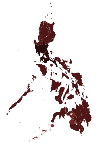
| kiwari | 6 Juni 2021 06.10 | | 4.200 × 6.105 (2,02 MB) | HueMan1 | update |
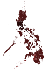
| 25 Januari 2021 01.57 |  | 4.200 × 6.105 (2,02 MB) | HueMan1 | Update | |
| 15 Oktober 2020 23.09 |  | 4.200 × 6.105 (2,02 MB) | Hariboneagle927 | Oct 15 | |
| 26 Agustus 2020 03.57 |  | 4.200 × 6.105 (2,02 MB) | HueMan1 | Update | |
| 13 Agustus 2020 15.32 |  | 4.200 × 6.105 (2,02 MB) | Hariboneagle927 | August 13 | |
| 17 Juni 2020 08.13 |  | 4.200 × 6.105 (2,02 MB) | Hariboneagle927 | update to June 16 as per the revamped DOH COVID-19 tracker https://www.doh.gov.ph/covid19tracker | |
| 12 Juni 2020 09.50 |  | 4.200 × 6.105 (2,02 MB) | Hariboneagle927 | update to June 10 http://geoportal.gov.ph/gpapps/covidapp | |
| 4 Juni 2020 11.35 |  | 4.200 × 6.105 (2,02 MB) | HueMan1 | Adjusted colours for 10000+ | |
| 22 Méi 2020 23.29 |  | 4.200 × 6.105 (2,02 MB) | Hariboneagle927 | May 22 | |
| 10 Méi 2020 17.15 |  | 4.200 × 6.105 (2,02 MB) | Hariboneagle927 | update May 10 |
Pamakéan berkas
Euweuh kaca anu maké ieu berkas.
Pamakéan berkas sajagat
Wiki lianna anu maké ieu berkas:
- Pamakéan di ar.wikipedia.org
- Pamakéan di ca.wikipedia.org
- Pamakéan di eu.wikipedia.org
- Pamakéan di he.wikipedia.org
- Pamakéan di id.wikipedia.org
- Pamakéan di min.wikipedia.org
- Pamakéan di nl.wikipedia.org
- Pamakéan di pt.wikipedia.org
- Pamakéan di www.wikidata.org
- Pamakéan di zh-yue.wikipedia.org